Not the easiest airport to make RT calls to, but the flight to Apalachicola was straight forward. Follow the coastline. A shadow was seen to pass slightly to the right from behind. Looking up a UH-1 or similar US military helicopter flew overhead, 1000 feet above.
Since leaving Lakeland and latterly Cedar Key, I had became obsessed about trying to get ahead of forecast storms. If I didn’t, I thought, then this could result in being grounded until April 23rd, still in the south eastern portion of the country. There would be no way I could complete my main goal. I needed to get ahead of the storm front that was being forecast. This led me to decide to not continue following the Florida coast line, as I had planned.

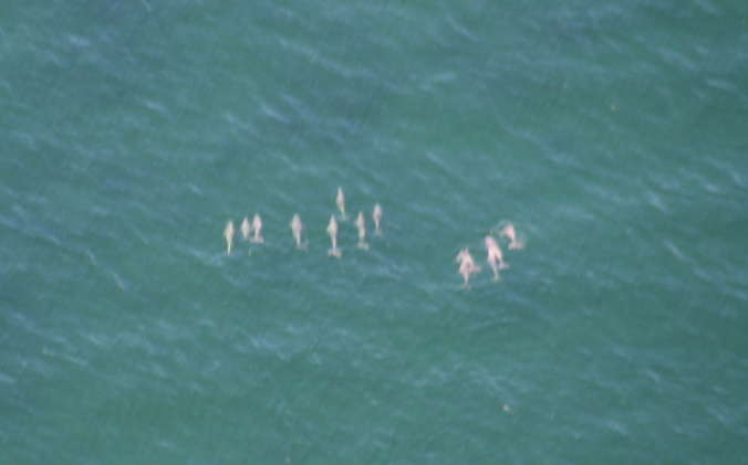
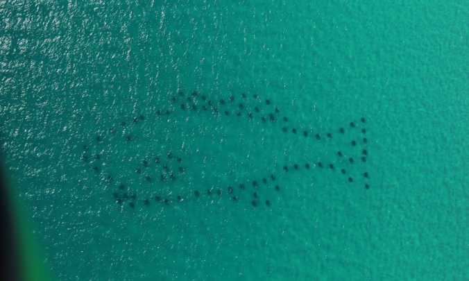
The detour offshore, resulted in the sightings of many dolphins 🙂


Alligator Point
The BZIM was approaching an area with a large number of MOA (Military Operating Areas) associated with Tyndall AFB. Staying along the coastline allowed transit below the 1000 feet lower limit of Tyndall G MOA. Aircraft flying VFR can fly into a MOA, but if the area is active with military traffic, its probably not best.

Dog Island strip. An planned airfield, but missed to save time
A PC12 was in the pattern as the BZIM joined tight downwind for runway 14 at Apalachicola. The surface wind was gusty, but straight down the runway. A very quick turn around thanks to FBO staff, the BZIM was airborne and heading for Jack Edwards, Alabama.

FBO staff at Apalachicola


Edits to this page will be done at a later date


What an adventure 👌👌👌😁😁
LikeLike